🖥️ Local Web Application#
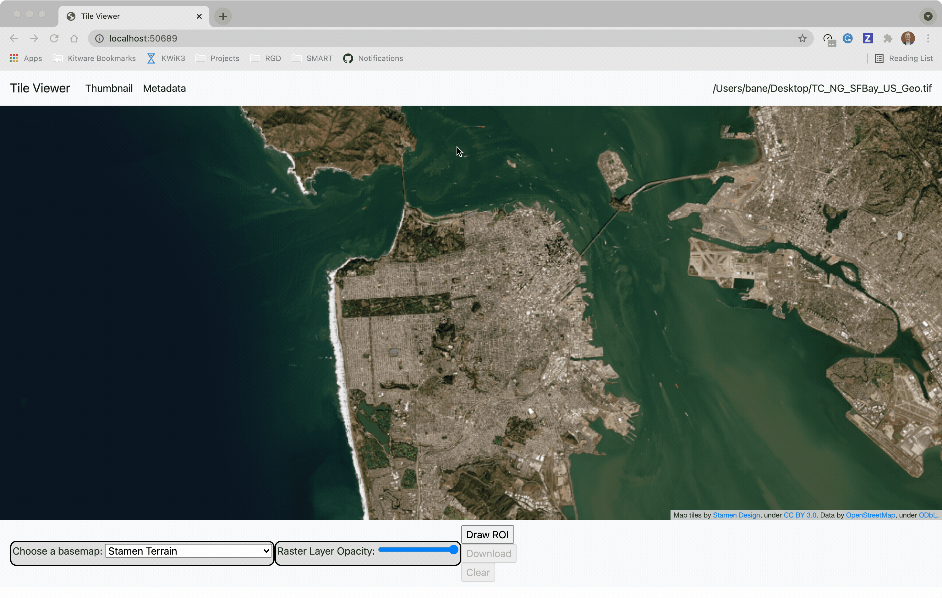
Launch the tileserver from the commandline to use the included web application where you can view the raster and extract regions of interest.
python -m localtileserver path/to/raster.tif
You can use the web viewer to extract regions of interest:
You can also launch the web viewer with any of the available example datasets:
python -m localtileserver dem
Available choices are:
demorelevation: global elevation datasetblue_marble: Blue Marble satellite imageryvirtual_earth: Microsoft’s satellite/aerial imageryarcgis: ArcGIS World Street Mapbahamas: Sample raster over the Bahamas